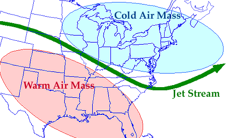
The jet stream is a current of fast moving air found in the upper levels of the atmosphere. This rapid current is typically thousands of kilometers long, a few hundred kilometers wide, and only a few kilometers thick. Jet streams are usually found somewhere between 10-15 km (6-9 miles) above the earth's surface. The position of this upper-level jet stream denotes the location of the strongest SURFACE temperature contrast (as in the diagram below).

During the winter months, Arctic and tropical air masses create a stronger
surface temperature contrast resulting in a strong jet stream. However,
during the summer months, when the surface temperature variation is less
dramatic, the winds of the jet are weaker.
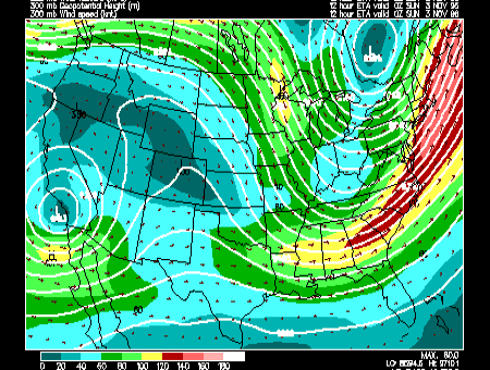
Below is an ETA Model forecast panel for 300 mb winds and geopotential heights (white contours). The color filled regions indicate wind speed in knots and is color coded according to the legend at the bottom of the image. The shades of blue indicate winds less than 60 knots, while winds greater than 120 knots are given in shades of red.

The yellow, green and red ribbon on the image above represents the jet
stream, and along the East Coast, the region of strongest winds (shaded in
red) is a
jet streak.