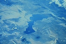
Before we went into space, science fiction stories treated space travel as a new form of air or sea travel. Nobody thought the real space program would be like riding a Ferris wheel—we get on, go in circles, then come down, and while we're up there we look mostly down at the ground. But the real payoff of space, for Earth science and for every other human endeavor, has been the new vantage point we get to look at Earth itself.
The view from space is a synoptic, all-in-one-eyeful view of our home world. We didn't take advantage of it right away for science, though. Space imagery has been practical first and scientific a distant second, for the most part. The earliest synoptic images were those taken by weather satellites and military sky spies, and both activities are still going strong.
 |
Satellite geology began in the 1970s with the Landsat program, which returned detailed images of every spot on the globe every 18 days. The digital images could be massaged and analyzed—for instance, to indicate geochemistry for prospecting purposes. And everywhere geologists found subtle lineaments on the ground that are too large even for aerial photos to encompass. (Most of these are probably fault lines.)
The U.S. government's Earth Resources Observation Systems or EROS center is the clearinghouse for Landsat imagery. They've got stuff ranging from utilitarian—pictures of your region with no annotations, for instance—to downright sensuous, like this false-color image of the MacDonnell Range in Australia. They also have photos taken by astronauts.
 |
SAR images can be made as detailed as visible-light pictures nowadays. Feast your eyes on a set of geology-related images from NASA's Jet Propulsion Laboratory. SAR also brings out subtleties of the ocean surface that are being further studied.
The biggest Earth-watching satellite program is probably the Earth Observing System (EOS) program. Check out the Earth Observatory to see the scope of this enterprise, which is much bigger than I have space to review. Among other things, there is a thorough treatment of satellite imagery, as good as a full-fledged seminar on the subject.
Then go play in the mother lode: NASA's Visible Earth site of satellite imagery that includes full-Earth pictures in true color. Between there and the other sites in my Earth Images from Space list, you'll never run out of things to see.