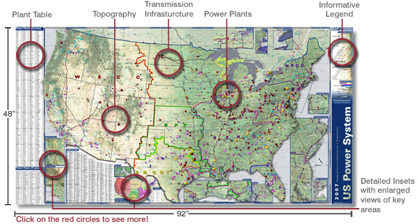
2007 U.S. Power System
Wall Map
Special Offer: Buy One Map, Get a Second Map FREE!!!*
Displays over Over 500 New or Expanding Power Plants
Hurry: Offer expires October 12, 2007!
CLICK MAP FOR MORE DETAILS

|
|
2007 U.S. Power
System Wall Map
NEW for 2007!!
The Most Up-to-Date Visual Reference
Tool on the U.S. Power System Available
Changes in the electric industry mandate a comprehensive
understanding of the U.S. power system. This stunning new map is the
largest, most detailed and up-to-date reference tool available for
energy professionals, financial institutions, power marketers,
merchant plant developers, or anyone else involved in this dynamic
industry.
Map Features:
- All Existing U.S. power plants 45 MW and above as of January
1, 2007?2,683 in total?defined by capacity, fuel mix, operator,
and regulatory status
- 419 proposed greenfield power plants, and 107 plant
expansions?defined by capacity, fuel mix, operator, and regulatory
status
- Over 500,000 miles of transmission lines indicated by
voltage?including over 22,000 miles of proposed lines
- Comprehensive plant data table listing power plants by name,
operator, capacity, and map location
- 11 regional insets showing detailed energy infrastructure in
enhanced detail
- Reference features include NERC regions overlaid on a detailed
base map with states, counties, major cities and towns, and the
latest aerial imagery of the continental U.S.
Details
Cost: $490.00 (lamination +$90.00)
Size: 48" x 92"
Data year: 2007
|
|
|