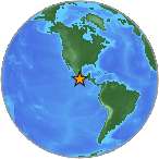
6.3 Mw - OAXACA, MEXICO
| Magnitude | 6.3 Mw |
| Date-Time |
|
| Location | 16.477N 98.286W |
| Depth | 12 km |
| Distances |
|
| Location Uncertainty | Horizontal: 15.0 km; Vertical 7.7 km |
| Parameters | Nph = 379; Dmin = 329.5 km; Rmss = 1.01 seconds; Gp = 46° M-type = Mw; Version = B |
| Event ID | US c0008ui2 |
For updates, maps, and technical information, see:
Event Page
or
USGS Earthquake Hazards Program
National Earthquake Information Center
U.S. Geological Survey
http://neic.usgs.gov/