7.0 Mw - EASTERN NEW GUINEA REG., P.N.G.
| Magnitude | 7.0 Mw |
| Date-Time |
|
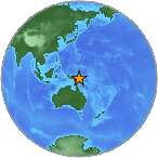
| Location | 5.482S 147.101E |
| Depth | 201 km |
| Distances |
|
| Location Uncertainty | Horizontal: 12.5 km; Vertical 3.1 km |
| Parameters | Nph = 334; Dmin = 381.8 km; Rmss = 0.82 seconds; Gp = 14° M-type = Mw; Version = 9 |
| Event ID | US c00095c9 |
For updates, maps, and technical information, see:
Event Page
or
USGS Earthquake Hazards Program
National Earthquake Information Center
U.S. Geological Survey
http://neic.usgs.gov/