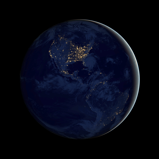
Suomi satellite shows Earth in black
Night-time view of planet referred to as the “Black Marble”
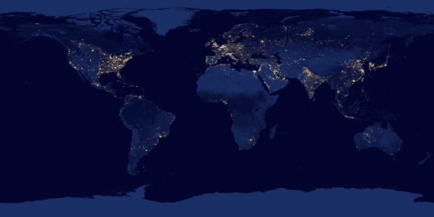
The image above — as well as the complementary collection below — comes from one of the most high-tech satellites in the sky right now, the Suomi spacecraft.
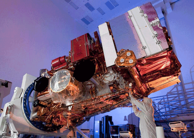
The Suomi was launched by NASA last year to deliver in-depth meteorological data. It’s already served its purpose across several projects, most recently — and perhaps most notably — while tracking Hurricane Sandy as it bore down on the Eastern Seaboard of the United States.

What differentiates Suomi from other spacecrafts is the low-light sensitivity of its Visible Infrared Imaging Radiometer Suite (VIIRS) instrument, which can tell the difference between everything from clouds to snow to fog, even when it’s looking at the dark side of the Earth.
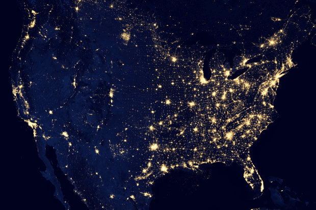
Another thing it’s obviously good at doing: capturing the lights of the cities all around the world.
The trick here is its special day-night band. Where a camera captures a whole picture in one exposure, the day-night band produces an image repeatedly by scanning a scene and resolving it as millions upon millions of individual pixels. After that, the system reviews the amount of light in each pixel and, if it’s very bright, a low-gain mode prevents the pixel from being over-saturated. If, on the other hand, the pixel is very dark, the signal gets amplified.
Suomi was originally launched under the title, “National Polar-orbiting Operational Environmental Satellite System Preparatory Project” satellite. Thankfully, it was renamed in honor of Earth observation scientist Verner E. Suomi.
Suomi cost $1.5bn to build and weighs two tons. It circles the globe — pole-to-pole — regularly, at an altitude of about 500 miles, during which its five on-board instruments monitor the behavior of the land, ocean and atmosphere.
These images were presented at the American Geophysical Union (AGU) Fall Meeting, which was held December 3-7, and is the largest annual gathering of Earth scientists.
To learn more about Suomi, go to npp.gsfc.nasa.gov ■
http://www2.electronicproducts.com/Image_of_the_Day_Suomi_satellite_shows_Earth_in_black-article-imjb_suomi_black_pearl_01_dec2012-html.aspx