6.4 Mw - NEAR EAST COAST OF HONSHU, JAPAN

| Parameter | Value | Uncertainty |
|---|---|---|
| Magnitude | 6.4 Mwp | ± 0.02 |
| Location | 38.894°N, 141.946°E | ± 15.5 km |
| Depth | 31.8 km | ± 7.0 km |
| Number of Stations Used | 556 | |
| Number of Phases Used | 560 | |
| Minimum Distance | 361.8 km (3.25°) | |
| Travel Time Residual | 0.94 sec | |
| Azimuthal Gap | 65° | |
| Review Status | REVIEWED | |
| Event ID | usb000ahy0 |
Moment Tensor
Moment Tensor EQXMLContributed Solutions
Seismic Network Preferred Location & Magnitude
| Source | Event ID | Time | Magnitude | Latitude | Longitude | Depth | Status | Download |
|---|---|---|---|---|---|---|---|---|
| NEIC | usb000ahy0 | 20:32:20 | 6.4 Mwp | 38.894°N | 141.946°E | 31.8 | REVIEWED | EQXML |
Moment Tensor
Downloads
All Downloads
| Product | Title | Links | ID |
|---|---|---|---|
| dyfi (US) | DYFI City Map | usb000ahy0 | |
| dyfi (US) | Intensity vs. Distance | usb000ahy0 | |
| dyfi (US) | Responses vs. Time | usb000ahy0 | |
| dyfi (US) | Intensity Summary | usb000ahy0 | |
| historical-moment-tensor-map (US) | Historic USGS Moment Tensor Solutions Map | usb000ahy0 | |
| historical-moment-tensor-map (US) | Historic USGS Moment Tensor Solutions Table | usb000ahy0 | |
| losspager (US) | Exposure Map | usb000ahy0 | |
| losspager (US) | onePAGER summary | usb000ahy0 | |
| losspager (US) | PAGER XML results | usb000ahy0 | |
| losspager (US) | PAGER Exposure KML | usb000ahy0 | |
| moment-tensor (US) | Earthquake XML (EQXML) | usb000ahy0 | |
| origin (US) | Earthquake XML (EQXML) | usb000ahy0 | |
| p-wave-travel-times (US) | Theoretical P-Wave Travel Times Map for the World | usb000ahy0 | |
| p-wave-travel-times (US) | Theoretical P-Wave Travel Times Table | usb000ahy0 | |
| phase-data (US) | Earthquake XML (EQXML) | usb000ahy0 | |
| shakemap (US) | XML Grids | usb000ahy0 | |
| shakemap (US) | Rock Grid | usb000ahy0 | |
| shakemap (US) | Uncertainty Grid | usb000ahy0 | |
| shakemap (US) | Text Grids | usb000ahy0 | |
| shakemap (US) | GIS Files | usb000ahy0 | |
| shakemap (US) | HAZUS Data | usb000ahy0 | |
| shakemap (US) | Station Lists | usb000ahy0 | |
| shakemap (US) | Metadata | usb000ahy0 | |
| shakemap (US) | Supplemental Information | usb000ahy0 | |
| shakemap (US) | TV Info Sheet | usb000ahy0 | |
| shakemap (US) | Intensity Thumbnail | usb000ahy0 | |
| shakemap (US) | Intensity Map | usb000ahy0 | |
| shakemap (US) | PGA Map | usb000ahy0 | |
| shakemap (US) | PGV Map | usb000ahy0 | |
| shakemap (US) | PSA03 Map | usb000ahy0 | |
| shakemap (US) | PSA10 Map | usb000ahy0 | |
| shakemap (US) | PSA30 Map | usb000ahy0 | |
| shakemap (US) | TV Map | usb000ahy0 | |
| shakemap (US) | Bare TV Map | usb000ahy0 | |
| shakemap (US) | Uncertainty Map | usb000ahy0 |
The use of EQXML formatted data is temporary. This data will be changing to QuakeML v1.2RC3 format.
- 17 Jun 2012 20:32:20 UTC
- 18 Jun 2012 05:32:20 near epicenter
- 17 Jun 2012 12:32:20 standard time in your timezone
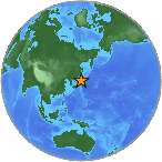
- 115 km (72 miles) SE (142 degrees) of Morioka, Honshu, Japan
- 117 km (73 miles) NE (52 degrees) of Sendai, Honshu, Japan
- 182 km (113 miles) NE (45 degrees) of Fukushima, Honshu, Japan
- 408 km (254 miles) NNE (28 degrees) of TOKYO, Japan
M-type = Mw; Version = 9
For updates, maps, and technical information, see:
Event Page
or
USGS Earthquake Hazards Program
National Earthquake Information Center
U.S. Geological Survey
http://neic.usgs.gov/