Warmest U.S. Spring On Record: NOAA
Date: 08-Jun-12
Country: USA
Author: Deborah Zabarenko
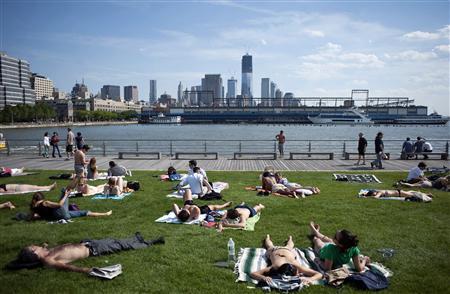
People lay out on the grass in the sun along a pier facing the
Hudson River in New York in this file photo taken May 13, 2012. So
far, 2012 has been the warmest year the United States has ever seen.
Photo: Keith Bedford/Files
So far, 2012 has been the warmest year the United States has ever seen, with the warmest spring and the second-warmest May since record-keeping began in 1895, the U.S. National Oceanic and Atmospheric Administration reported on Thursday.
Temperatures for the past 12 months and the year-to-date have been the warmest on record for the contiguous United States, NOAA said.
The average temperature for the contiguous 48 states for meteorological spring, which runs from March through May, was 57.1 degrees F (13.9 C), 5.2 degrees (2.9 C) above the 20th century long-term average and 2 degrees F (1.1 C) warmer than the previous warmest spring in 1910.
Record warmth and near-record warmth blanketed the eastern two-thirds of the country from this spring, with 31 states reporting record warmth for the season and 11 more with spring temperatures among their 10 warmest.
"The Midwest and the upper Midwest were the epicenters for this vast warmth," Deke Arndt of NOAA's Climatic Data Center said in an online video. That meant farming started earlier in the year, and so did pests and weeds, bringing higher costs earlier in the growing season, Arndt said.
"This warmth is an example of what we would expect to see more often in a warming world," Arndt said.
More long-lasting heat waves, record-high daytime temperatures and record-high overnight low temperatures are to be expected in a warming world, said Jake Crouch of NOAA's National Climatic Data Center.
CARBON DIOXIDE MILESTONE
"And that's what we're seeing," Crouch said by telephone. "We've seen it quite a bit over the last 12 months."
Alaska's spring months were 2.7 degrees F (1.5 C) cooler than average and 10.5 percent wetter and snowier, while drought spread over Hawaii, though exceptional drought was eliminated across the island state.
Warmth was evident in parts of the Arctic in May, where sea ice declined rapidly at first and then more slowly through the month, ending at below average levels for 1979-2000, according to the National Snow and Ice Data Center.
However, there was more ice cover in the Arctic in May 2012 than in May 2011, the center said on Wednesday on its website nsidc.org/arcticseaicenews/ . There was heavy ice in the Bering Sea, but unusually low ice extent in the Barents and Kara Seas.
Another Arctic measurement related to climate reached a milestone this spring, NOAA reported: the concentration of atmospheric carbon dioxide at Barrow, Alaska, reached 400 parts per million, the first time a monthly average for this greenhouse gas passed that level at a remote location.
The level of 450 ppm is regarded by many scientists and environmental activists as the upper limit the planet can afford if global temperature rise is to be kept to within 3.6 degrees F (2 C) this century. Some advocates suggest 350 ppm is a more appropriate target.
The 400 ppm mark for carbon dioxide in less remote locations, such as Cape May, New Jersey, has been reached for several years in the springtime, NOAA said in a statement.
But measurements of carbon dioxide over 400 ppm at remote sites like Barrow - and at six other remote Arctic sites - reflect long-term human emissions of the climate-warming gas, rather than direct emissions from a nearby population center.
The global monthly mean level of atmospheric carbon dioxide was about 394 ppm in April, compared to 336 ppm in 1979, pre-industrial levels of about 278 ppm and ice age levels of about 185 ppm.
(Editing by Vicki Allen)
![]()
© Thomson Reuters 2012 All rights reserved