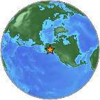
6.0 Ml - GULF OF ALASKA
| Magnitude | 6.0 Ml |
| Date-Time |
|
| Location | 57.854N 142.914W |
| Depth | 15 km |
| Distances |
|
| Location Uncertainty | Horizontal: 0.4 km; Vertical 3.4 km |
| Parameters | Nph = 141; Dmin = 251.6 km; Rmss = 1.01 seconds; Gp = 133° M-type = Ml; Version = 1 |
| Event ID | ak 10598710 |
For updates, maps, and technical information, see:
Event Page
or
USGS Earthquake Hazards Program
Alaska Earthquake Information Center
Geophysical Institute, University of Alaska Fairbanks
http://www.aeic.alaska.edu