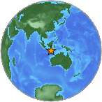
6.4 Mwp - SOUTH OF JAVA, INDONESIA
| Magnitude | 6.4 Mwp |
| Date-Time |
|
| Location | 10.785S 113.880E |
| Depth | 8 km |
| Distances |
|
| Location Uncertainty | Horizontal: 12.5 km; Vertical 3.7 km |
| Parameters | Nph = 227; Dmin = 258.3 km; Rmss = 1.04 seconds; Gp = 24° M-type = Mwp; Version = A |
| Event ID | us c000ce33 |
For updates, maps, and technical information, see:
Event Page
or
USGS Earthquake Hazards Program
National Earthquake Information Center
U.S. Geological Survey
http://neic.usgs.gov/