New Sinking Islands and Lands
The seas do rise and fall over the ages. Lands sink and rise depending on the weather. Dynamic modeling of sea-level rise, which takes storm wind and wave action into account, paints a much graver picture for some low-lying Pacific islands under climate-change scenarios than the passive computer modeling used in earlier research, according to a new report. A team led by research oceanographer Curt Storlazzi of the USGS Pacific Coastal and Marine Science Center compared passive bathtub inundation models with dynamic models for two of the Northwestern Hawaiian Islands in the Papahānaumokuākea Marine National Monument. The team studied Midway, a classic atoll with islands on the shallow (2—8 meters or 6—26 feet deep) atoll rim and a deep, central lagoon, and Laysan, which is higher, with a 20—30 meter (65—98 feet) deep rim and an island in the center of the atoll. Together, the two locations exhibit landforms and coastal features common to many Pacific islands.
"Passive bathtub inundation models typically used to forecast sea-level rise impacts suggest that most of the low-lying atolls in the Pacific Islands will still be above sea level for the next 50-150 years. By taking wave-driven processes into account, we forecast that many of the atolls will be inundated, contaminating freshwater supplies and thus making the islands uninhabitable, much sooner," Storlazzi said.
Bathtub inundation is about the displacement of liquid water volume by melting ice volume. In simple language is if melted ice water adds 100 cubic feet of water, the the ocean level will go X inches. What this study does is to study the additional effects caused by other water phenomena such was waves.
The team found that at least twice as much land is forecast to be inundated on Midway and Laysan by sea-level rise than was projected by passive models. For example, 91 percent of Midway's Eastern Island is projected to be inundated under a model that takes into account storm and wave activity accompanied by a sea-level rise of 2 meters (6.5 feet), as compared with only 19 percent under passive sea-level-rise models. Storm waves on Midway are also projected to be three to four times higher than they are today, because more deep-water wave energy could propagate over the atoll rim and larger wind-driven waves could develop on the atoll.
"This report demonstrates the future threat to refuges with the Monument, and the potential impact on nesting seabirds, endangered monk seals and green sea turtles will be considered as we plan for the future,: said Doug Staller, the Service's Superintendent of the Papahānaumokuākea Marine National Monument.
These findings have importance not only for island wildlife on the largely uninhabited Northwestern Hawaiian Islands, Storlazzi said, but for the tens of thousands of people who live on other low-lying Pacific Island groups such as those found in the Republic of the Marshall Islands and the Federated States of Micronesia. Because the models attempt to characterize how much land will be washed over by storm waves even if it is not permanently inundated, they offer tools for forecasting where agricultural land may be damaged by repeated saltwater over wash, as well as where groundwater may be contaminated by saltwater. The findings suggest that inundation and impacts to infrastructure and terrestrial habitats will occur at lower values of predicted sea-level rise, and thus sooner in the 21st century, than suggested by passive map-based bathtub inundation models.
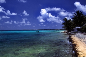
Many media reports have focused on the island nations of the Pacific, notably the Polynesian islands of Tuvalu, which based on more severe flooding events in recent years, were thought to be "sinking" due to sea level rise. A scientific review in 2000 reported that based on University of Hawaii gauge data, Tuvalu had experienced a negligible increase in sea level of about 0.07 mm a year over the past two decades, and that climate effects had been a larger factor in Tuvalu's higher tides in recent years.
The report, "Forecasting the Impact of Storm Waves and Sea-Level Rise on Midway Atoll and Laysan Island within the Papahānaumokuākea Marine National Monument—A Comparison of Passive Versus Dynamic Inundation Models," is available online.
For further information see Storm Waves.
Tuvalu image via Wikipedia.
2013©. Copyright Environmental News Network