Dry crop belt counts on more than a drop of February rain
Date: 20-Feb-13
Country: USA
Author: Sam Nelson
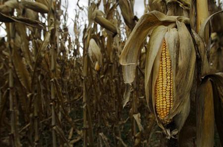
The last of the 2012 drought-stricken corn is seen at Mayne's Tree
Farm in Buckeystown, Maryland October 27, 2012.
Photo: Gary Cameron
Wheat and corn farmers are banking on more rain and snow in late February so they can keep nursing depleted soil back to healthier levels of moisture amid the worst drought in the United States grain belt in more than 50 years.
Agricultural meteorologists said on Tuesday that the precipitation in the next week to 10 days will provide significant relief for crop prospects in the U.S. Plains and Midwest.
John Dee, meteorologist for Global Weather Monitoring, said "this will really help add to soil moisture levels."
Dee said .50 inch to 1 inch of rain could be expected over most of the Plains hard red winter wheat region late this week with a similar system bringing rain and snow again next week.
"There also will be a lot of snow in the north, up to a foot in some areas, and this will really help as it will melt close to planting time," Dee said.
He said the driest areas of the Plains, Iowa, Nebraska and Minnesota, would receive the lion's share of the precipitation.
Commodity Weather Group (CWG) said the most significant storm will arrive Wednesday through early Friday and favor the Plains and western Midwest. CWG meteorologist Joel Widenor said there could be at least 6 inches to 12 inches of snowfall for much of the Central Plains and western Midwest.
"Some drought relief will occur," Widenor said.
The chief bread grain hard red winter wheat crop grown in the U.S. Plains soon will break from its winter slumber and enter its rapid growth stage of development. At the same time, farmers are itching to get into corn fields to plant what could be a record crop, assuming big spring rains bring soil moisture reserves back up to normal.
Harsh drought conditions persisted in U.S. farm states over the last week but some improvement was noted thanks to recent rain and snow, climate experts said on Thursday.
The weekly Drought Monitor report issued by a consortium of state and federal climatologists showed the key farming states in the High Plains region remain drought stricken, although improvement was noted with severe or worse levels of drought at 82.51 percent of the region, down from 87.25 percent a week earlier.
Don Keeney, meteorologist for MDA EarthSat Weather said roughly 4 inches to 6 inches of rain is needed in Kansas, the top producer of hard red winter wheat, to bring the state out of drought status. And up to 8 inches is needed in a pocket of severe dryness in northeastern Kansas, a big corn and grain sorghum growing area.
Similar amounts are needed in Nebraska, Texas, Oklahoma, Iowa and Missouri and the northern reaches of Illinois and Indiana.
Significant winter rainfall and snow has eliminated the drought for now in an area roughly from Illinois eastward, according to Keeney.
The Senate Agriculture Committee was told on Thursday that 56 percent of the contiguous United States was under moderate to exceptional drought, twice the usual amount.
(Additional reporting by Carey Gillam in Kansas City, Karl Plume in Chicago and Chuck Abbott in Washington; Editing by Grant McCool)
![]()
© Thomson Reuters 2013 All rights reserved