The Seas Rise but the Lands Rise Too
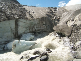
As the Arctic ice melts it will raise the sea level. But as it does it removes the enormous weight of the ice and the land will rise too in places, Sophisticated computer modelling has shown how sea-level rise over the coming century could affect some regions far more than others. The model shows that parts of the Pacific will see the highest rates of rise while some polar regions will actually experience falls in relative sea levels due to the ways sea, land and ice interact globally. Reporting in the journal Geophysical Research Letters researchers have looked ahead to the year 2100 to show how ice loss will continue to add to rising sea levels. Scientists have known for some time that sea level rise around the globe will not be uniform, but in this study the team of Ice2sea researchers show in great detail the global pattern of sea-level rise that would result from two scenarios of ice-loss from glaciers and ice sheets.
The team, from the University of Urbino and the University of
Bristol, found that ice melt from glaciers, and the Greenland and
Antarctic ice sheets, is likely to be of critical importance to regional
sea-level change in the Equatorial Pacific Ocean where the sea level
rise would be greater than the average increase across the globe. This
will affect in particular, Western Australia, Oceania and the small
atolls and islands in this region, including Hawaii.
The study focused on three effects that lead to global mean sea-level
rise being unequally distributed around the world. Firstly, land is
subsiding and emerging due to a massive loss of ice at the end of the
last ice age 10,000 years ago when billions of tons of ice covering
parts of North America and Europe melted. This caused a major
redistribution of mass on the Earth, but the crust responds to such
changes so slowly that it is still deforming.
Post-glacial rebound is the rise of land masses that were depressed by
the huge weight of ice sheets during the last glacial period, through a
process known as isostasy. It affects northern Europe (especially
Scotland, Fennoscandia and northern Denmark), Siberia, Canada, the Great
Lakes of Canada and the United States, the coastal region of the US
state of Maine, parts of Patagonia, and Antarctica.
Studies have shown that the uplift has taken place in two distinct
stages. The initial uplift following deglaciation was near-instantaneous
due to the elastic response of the crust as the ice load was removed.
After this elastic phase, uplift proceeded by slow viscous flow so the
rate of uplift decreased exponentially after that. Today, typical uplift
rates are of the order of 1 cm/year or less. In northern Europe, this is
clearly shown by the GPS data obtained by the BIFROST GPS network.
Studies suggest that rebound will continue for about at least another
10,000 years. The total uplift from the end of deglaciation depends on
the local ice load and could be several hundred meters near the center
of rebound.
Secondly, the warming of the oceans leads to a change in the
distribution of water across the globe. Thirdly the sheer mass of water
held in ice at the frozen continents like Antarctica and Greenland
exerts a gravitational pull on the surrounding liquid water, pulling in
enormous amounts of water and raising the sea-level close to those
continents. As the ice melts its pull decreases and the water previously
attracted rushes away to be redistributed around the globe.
Co-author Professor Giorgio Spada of the University of Urbino said: "In
the paper we are successful in defining the patterns, known as sea level
fingerprints, which affect sea levels."
"This is paramount for assessing the risk due to inundation in
low-lying, densely populated areas. The most vulnerable areas are those
where the effects combine to give the sea-level rise that is
significantly higher than the global average."
He added that in Europe the sea level would rise but it would be
slightly lower than the global average.
"We believe this is due to the effects of the melting polar ice
relatively close to Europe — particularly Greenland’s ice. This will
tend to slow sea-level rise in Europe a little, but at the expense of
higher sea-level rise elsewhere."
The team considered two scenarios in its modelling. One was the most
likely or mid-range and the other closer to the upper limit of what
could happen.
Professor Spada said, "The total rise in some areas of the equatorial
oceans worst affected by the terrestrial ice melting could be 60cm if a
mid-range sea-level rise is projected, and the warming of the oceans is
also taken into account."
David Vaughan, ice2sea program coordinator, said: "In the last couple of
years programs like ice2sea have made great strides in predicting global
average sea-level rise. The urgent job now is to understand how global
the sea-level rise will be shared out around the world’s coastlines.
Only by doing this can we really help people understand the risks and
prepare for the future."
For further information see
Sea Rise.
Melting Glacier image via Wikipedia.
©2013. Copyright Environmental News Network To subscribe or visit go to: http://www.enn.com