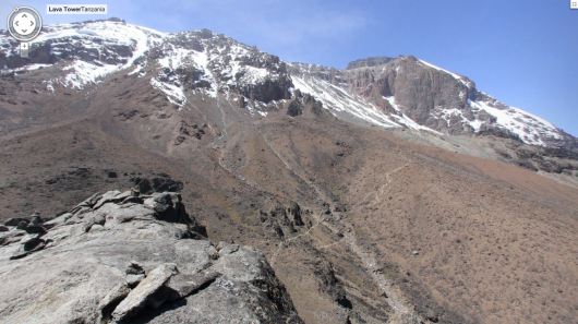
The view from the top of Mount Kilimanjaro through Google Maps Street View
Google Maps is the first place most internet users look to for views of the world that might be otherwise unreachable. Google is expanding that service, with detailed views from the tops of mountains. Most of us will never be able to climb any of the world's tallest peaks, but with Google Maps Street View, at least we can see what it would be like if we did.
Google and its team of Street View photographers ventured to Aconcagua in South America, Mount Kilimanjaro in Africa, Mount Elbrus in Europe, and the Everest Base Camp in Asia. Google cites its goal as allowing users to venture "to the top of these peaks and enjoy the sights without all of the avalanches, rock slides, crevasses, and dangers from altitude and weather that mountaineers face."
Google's team captured the images using a simple tripod and a digital camera with a fish-eye lens. The team cataloged their adventures while taking the photos on Google's Lat-Long blog. This offers a little more insight into what it took for the team to capture these impressive photos.
The views from the mountains are available through the browser version of Google Maps and on mobile through an iOS and Android device.
Source: Google
Copyright © gizmag 2003 - 2013 To subscribe or visit go to: http://www.gizmag.com


