Interactive map, geo-dataset improve wind energy project siting
The first publicly-available interactive map and geo-dataset has been released, showing more than 47,000 onshore wind turbine locations and related information across the entire United States. The new tool is consistent with the goals of Secretary of the Interior Sally Jewell's Order (No. 3330) released in October 2013 to incorporate a landscape-level approach to development on public lands.
 |
|
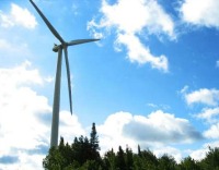
Credit: U.S. Geological Survey |
"In making this critical information available to the public, the USGS has provided public agencies and private companies with a new tool to help guide smart landscape-level planning decisions that support domestic energy production while minimizing conflicts," said Secretary Jewell in a statement. "The data will help improve the siting of future wind energy projects as well as aid land managers in devising more up-to-date land-use and multiple-use plans."
The wind turbine map, which includes turbines installed as of July 2013, was created by combining publicly available data sets from the Federal Aviation Administration, the U.S. Energy Information Administration, the Oak Ridge National Laboratory, as well as other federal, state and local sources. USGS researchers identified additional turbines not in those databases and added them to the dataset and map. Before the release of the interactive map, some individual state maps with turbine information and national maps of facility information existed, but there were no national maps with turbine-specific information and verified locations.
"In addition to informing siting decisions for future wind energy projects, this fundamental, nationwide data will support research on wind generation efficiency, economic impacts, and applied science for reducing wildlife impacts," said Assistant Secretary for Water and Science Anne Castle. "Just as we need basic information about stream flows to support good water administration decisions, we must have accurate data on wind generation to better understand and support this important source of renewable energy."
Having wind turbine-level data available in this new format will improve the ability to study a number of factors associated with renewable energy development, including air wakes caused by the turbines, interactions between wind turbines and ground-based radar, and more.
For more:
- see this
Order
- see this
map
2014 FierceMarkets, a division of Questex Media Group LLC. All rights reserved.