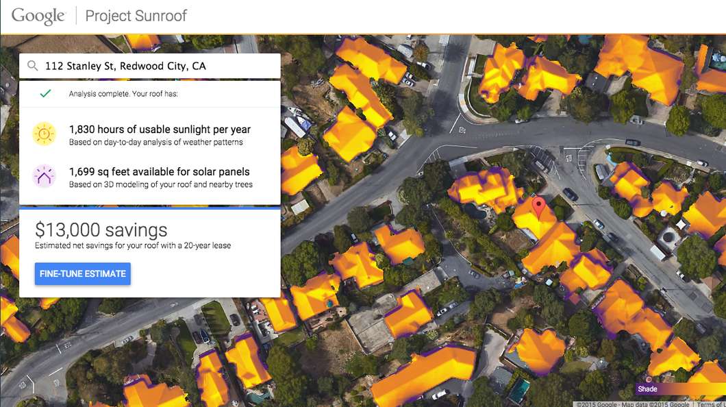
Ever balked at installing solar panels on your roof because it's pretty damn expensive or you're not sure how much power it would actually generate, or a combination of both? Well, a new venture from Google is aimed at taking the guesswork out of weaning your household off the grid. Powered by Google Maps, Project Sunroof can tell users how much sun is hitting their roof and how much they might be able to shave off their power bills.
According to Google, it already has access to all the information needed to create detailed maps of your rooftop's candidacy for solar harvesting. It combines Google Maps' extensive database of aerial images with 3D modeling of the roof, taking into account shade offered by nearby objects likes trees, possible sun positions and cloud and temperature patterns in the area.
This results in a customized analysis of your roof's solar potential. Project Sunroof then tells you how many hours of usable sunlight your roof is exposed to, how much of that is available for placing solar panels and the savings in store if you decide to go ahead.
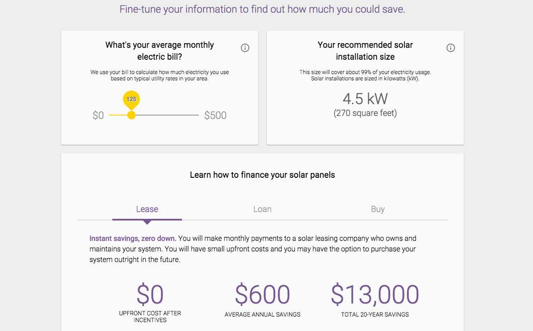
Figures are offered up for different scenarios, such as leasing solar panels, taking out a loan to pay for them or buying them outright. Google says the figures are based on current solar industry pricing and consider federal and state tax credits, utility rebates, renewable energy credits and net metering. If the numbers are looking good, Google also offers up the contact details of local solar providers to get the ball rolling.
To begin with, Google has only introduced the service to residents of Boston, San Francisco Bay Area and Fresno. It says soon it will grow to cover the entire US and afterwards, the whole globe.
The video below provides a quick overview of Project Sunroof.
Source: Google