The Inka Road stretches over 24,000 miles through six
modern-day countries: Colombia, Ecuador, Peru, Bolivia,
Argentina, and Chile. It stands among the great feats of
engineering in world history, serving as a network that
linked Cusco (in modern-day Peru) with the far reaches of
the Inka empire. The Inka road ranges over mountains,
tropical lowlands, rivers and deserts and is still crucial
in uniting contemporary Andean communities.
On Friday, June 26, the National Museum of the American
Indian in Washington, DC, will open the exhibition "The
Great Inka Road: Engineering an Empire," which will tell
the historical and cultural story of the Inka Road from its
beginnings in early Andean cultures to its significance to
the Inka Empire and its use in the modern era. The
experience features over 140 objects, the oldest being
a ceramic Chavín stirrup spout bottle dating from ca.
800–100 B.C., numerous videos and a wealth of photography.
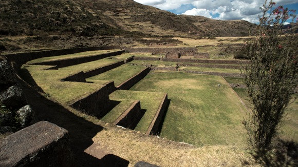
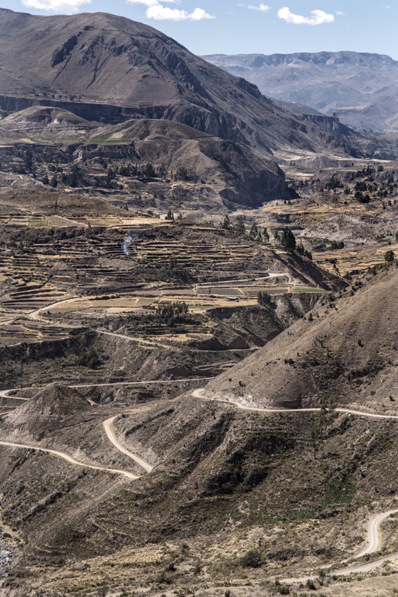
Agricultural terraces on a steep hillside. Colca Canyon,
Peru, 2014. Photo by Doug McMains, National Museum of
the American Indian, Smithsonian Institution.
The pictures and information are collected in the book The
Great Inka Road: Engineering an Empire, edited by Ramiro
Matos Mendieta (Quechua) and José Barreiro (Taíno),
available at the NMAI store.
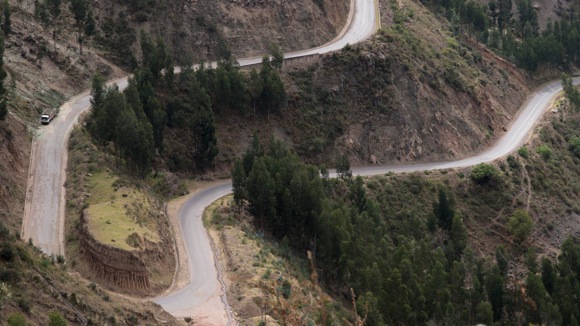
Modern Andean highways. Near Q’eswachaka, Canas
Province, Peru, 2014. Photo by Doug McMains, National
Museum of the American Indian, Smithsonian Institution.
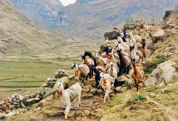
A llama caravan travels the Inka Road. Warautambo, Peru,
1990. Photo by Ramiro Matos Mendieta, National Museum of
the American Indian, Smithsonian Institution.
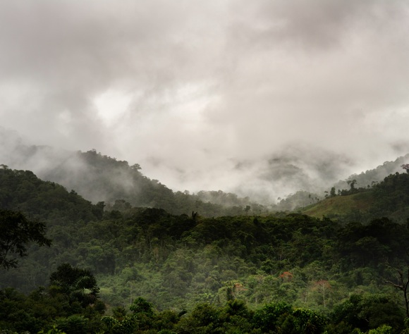
The upper Amazon, near Loromayo, Peru, 2014. Photo by
Doug McMains, National Museum of the American Indian,
Smithsonian Institution
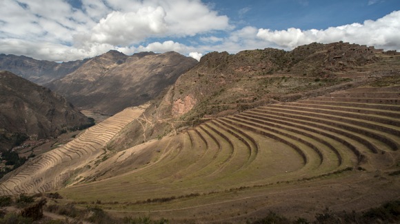
Terraces have allowed the Inka and their descendants to
transform steep terrain into viable agricultural land.
Pisac, Peru, 2014. Photo by Doug McMains, National
Museum of the American Indian, Smithsonian Institution.
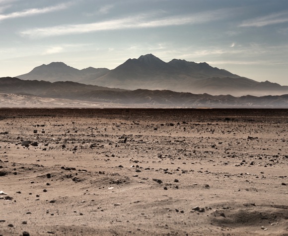
The coastal desert of Peru, with the Andean highlands
visible in the distance. Near Camana, Peru, 2014. Photo
by Doug McMains, National Museum of the American Indian,
Smithsonian Institution
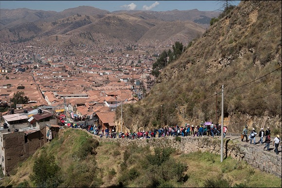
Families walk from the center of Cusco toward the temple
site at Sacsayhuaman to celebrate Inti Raymi, the Inka
Festival of the Sun. Cusco, Peru; June 2014. Photo by
Doug McMains, NMAI.
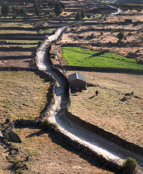
An Inka road with sidewalls cuts through an agricultural
valley. Colca Canyon, Peru, 2014. Photo by Doug McMains,
National Museum of the American Indian, Smithsonian
Institution.
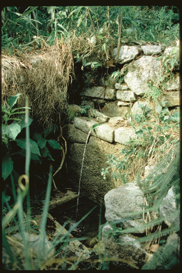
Trailside water fountain, Machu Picchu, Peru (Wright
Water Engineers, Inc., 1998)
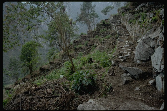
Portion of the east flank trail at Machu Picchu, Peru
(Wright Water Engineers, Inc., 1998)
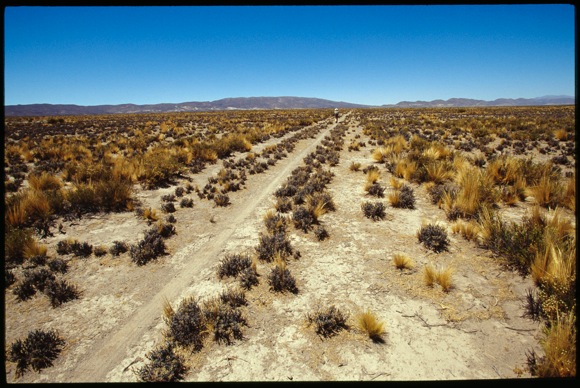
The Inka Road through the desert. Jujuy Province near
the Bolivian border, Argentina. Photo by Megan Son and
Laurent Granier, 2006.
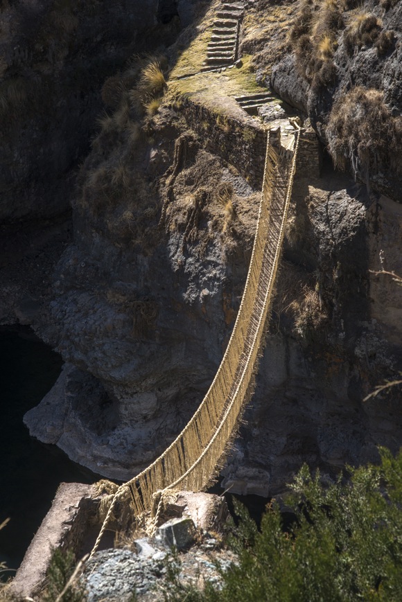
Q'eswachaka suspension bridge. Q'eswachaka, Apurimac
River, Canas Province, Cusco, Peru. Photo by Doug
McMains, 2014.
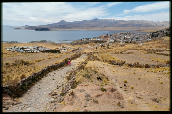
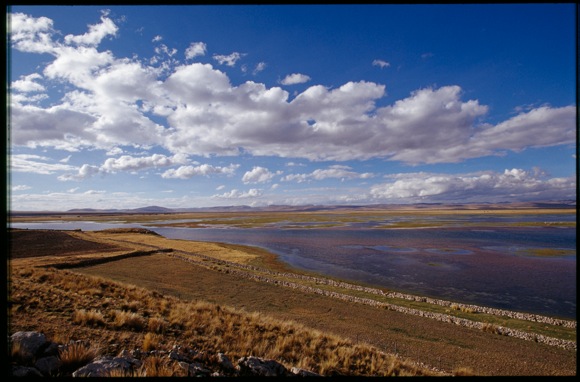
A woman travels the Inka Road on the shores of Lake
Titicaca near Pomata, Peru. Photo by Megan Son and
Laurent Granier, 2006.
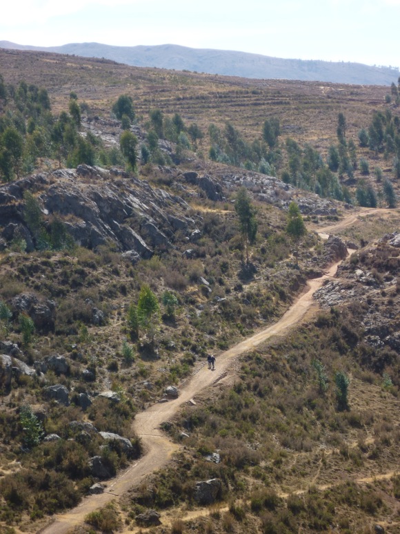
Two men walk the Inka Road, Charazani, Bolivia. Photo by
Ramiro Matos, 2011.
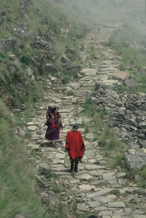
Walking the Qhapaq Ñan Jujuy, Argentina Photo by Axel E.
Nielsen, 2005
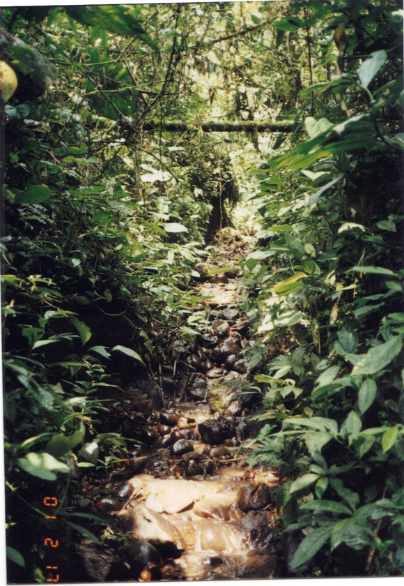
Inka road in the upper Amazon, Quijos River Valley,
Ecuador. Photo by Jorge Arellano, 2001.
The Qhapaq Nan in Contisuyu, Colca Canyon, Peru. Photo
by Doug McMains, 2014.
Trailside water fountain, Machu Picchu, Peru (Wright
Water Engineers, Inc., 1998)
Portion of the east flank trail at Machu Picchu, Peru
(Wright Water Engineers, Inc., 1998)
The Inka Road through the desert. Jujuy Province near
the Bolivian border, Argentina. Photo by Megan Son and
Laurent Granier, 2006.
Q'eswachaka suspension bridge. Q'eswachaka, Apurimac
River, Canas Province, Cusco, Peru. Photo by Doug
McMains, 2014.
A woman travels the Inka Road on the shores of Lake
Titicaca near Pomata, Peru. Photo by Megan Son and
Laurent Granier, 2006.
Two men walk the Inka Road, Charazani, Bolivia. Photo by
Ramiro Matos, 2011.
Walking the Qhapaq Ñan Jujuy, Argentina Photo by Axel E.
Nielsen, 2005
Inka road in the upper Amazon, Quijos River Valley,
Ecuador. Photo by Jorge Arellano, 2001.
The Qhapaq Nan in Contisuyu, Colca Canyon, Peru. Photo
by Doug McMains, 2014.
The Inka Road skirting Lake Junin, just south of Pumpu,
a large Inka administrative center. Lake Junin, Peru.
Photo by Megan Son and Laurent Granier, 2006.
© 1998 -
2015 Indian
Country Today. All Rights Reserved To subscribe or visit go to:
http://www.indiancountry.com