How a hotspot in the Earth's mantle fooled the scientists tracking Greenland's ice loss

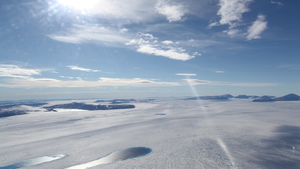
Greenland didn't shed about 2,500 gigatons of ice between 2003 and 2013, as satellite measurements had indicated, but almost 2,7000 gigatons instead(Credit: Ohio State
Today, an ultra-hot column of partial molten rock lies beneath Iceland and feeds the country's dramatic volcanic landscape, but it wasn't always this way. Due to the slow-shifting of Earth's crust in the region, this same hotspot sat beneath Greenland millions of years ago. And when it did, a new study has found, it softened the mantle rock in a way that has recently come to fool scientists trying to gauge ice loss in the area. So much so, that it has been losing around 20 gigatons per year more than we previously thought.
Because gravity is related to mass, scientists are able to use satellites to map the Earth's gravitational field and make assessments on the overall structure of the planet. As some surface features contain more mass than others, the resulting variations in gravity can allow them to measure things like water stored below and above the ground, mass within the Earth and melting ice sheets.
But the thing is, this method doesn't quite paint a complete picture. It will tell scientists if there is a loss in mass but not whether that mass was made up of land, ice, or a combination of the two. So when making a judgement on the scale of ice melt, they rely on modeling of rock flow within the Earth to fill in the gaps.
But new research carried out by an international team of scientists has revealed that the standard models used may be a little off, give or take a few billion metric tons.
The reason for this is that when Greenland passed over this hotspot 40 million years ago, it softened and lowered the viscosity of the rock in the mantle beneath the country's east coast. In the last ice age when Greenland's ice sheet was a lot bigger than it is now, it pressed the crust into the softened mantle underneath.
Then when the Ice Age came to an end, around 11,500 years ago, the decreasing weight of the ice sheet on top allowed the crust to rebound and mantle rock to flow inwards and upwards underneath Greenland. This is still happening today, and as it turns out, at faster rate than scientists had thought.

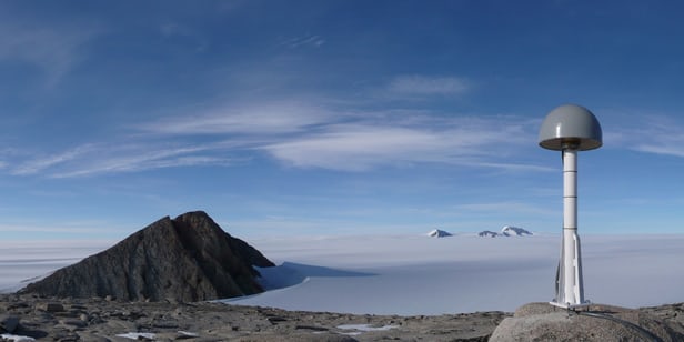
By installing 50 GPS units along the coastline, the team behind the new study set out to measure the lifting crust and they found that two particular locations were rising a lot quicker than models had predicted.
"We did not expect to see the anomalous uplift rates at the two stations that sit on the 'track' of the Iceland hot spot," says study co-author Michael Bevis. "We were shocked when we first saw them. Only afterwards did we make the connection."
The upshot of this discovery is that what researchers once thought was ice is really rock, so there's less ice around than previously thought. The new calculations show that Greenland didn't shed about 2,500 gigatons of ice between 2003 and 2013, as satellite measurements had indicated, but almost 2,700 gigatons instead, a difference of 7.6 percent. That sounds like a lot, but Bevis puts it into perspective.
"It's a fairly modest correction," he says. "It doesn't change our estimates of the total mass loss all over Greenland by that much, but it brings a more significant change to our understanding of where within the ice sheet that loss has happened, and where it is happening now."
More important than the 7.6 percent underestimation, the team says, is that they now have a clear picture of which parts of the ice sheet are most feeling the brunt of climate change, and in turn, how this will influence rising sea levels. It says that the findings will have ramifications for how ice loss is measured elsewhere in the world.
"This result is a detail, but it is an important detail," Bevis says. "By refining the spatial pattern of mass loss in the world's second largest — and most unstable — ice sheet, and learning how that pattern has evolved, we are steadily increasing our understanding of ice- loss processes, which will lead to better-informed projections of sea level rise."
The research was published in the journal Science Advances.
Source: Ohio State University