Coconino Plateau Basin
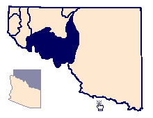 |
The Coconino Plateau basin covers about 5,548 square miles in
north-central Arizona (Figure 10). Situated in the Plateau uplands
province, the area is bounded on the north by the Colorado River as it
cuts through the Grand Canyon. To the southwest, the Coconino Plateau
borders with the Verde River and Peach Springs basins and to the east with
the Little Colorado Plateau basin. The boundary to the southwest and east
generally follows the surface-water divide with drainage flowing toward
the Colorado River. The topography is characterized by rolling high
plateaus, deeply-incised canyons, and rounded volcanic mountains.
Elevation above mean sea level ranges from over 12,000 feet on the San
Francisco Peaks, to 6,000-7,000 feet across the plateaus, to 1,500 feet
where the Colorado River exits the basin at the downstream end of the
Grand Canyon.
Characteristic of the Colorado Plateau, the Coconino Plateau basin is
composed of a relatively flat-lying sequence of sandstones, limestones,
and shales. Widely-spaced high-angle faults and monoclines cross the area
and provide structural control for the movement of groundwater along the
regional gradient. As outlined in McGavock and others (1986), the major
water-bearing units are divided into two aquifers, the Coconino aquifer
and the limestone aquifer. Although the Coconino aquifer is the main
source of groundwater in adjacent areas to the south and east, as
mentioned previously, it generally is drained of water in the Coconino
Plateau basin. Most of the water recharged in the area moves downward into
the underlying Supai Formation and the limestone aquifer along major
fracture zones. Near Tusayan, a 3,000-foot well recently drilled in
Section 24, Township 30 North, Range 2 East was completed in the
Mississippi Redwall Limestone. In 1989, the well had a reported yield of
80 gallons per minute and a static water level of 2,420 feet below land
surface. Exceptions exist, however, near Cataract Creek and Tusayan where
perched water is found at 950 feet and 500 feet below land surface,
respectively (McGavock and others, 1986). Well yields generally are less
than five gallons per minute.
The limestone aquifer consists of several hydraulically-connected
limestone, dolomite, sandstone, and shale units (McGavock and others,
1986). Most of the water in the aquifer is derived from the downward
migration of water from the overlying Coconino aquifer. Shale units within
the limestone aquifer impede the downward migration of water while
solution cavities and fracture zones provide avenues for lateral movement.
A large part of the groundwater moves northward and is discharged from
springs along the Little Colorado and Colorado Rivers and Havasu Creek.
The largest of these springs includes Blue Springs and Havasu Springs
which discharge 100,000 gallons per minute and 29,000 gallons per minute,
respectively (Johnson and Sanderson, 1968). The location of the
groundwater divide in the southern part of the basin is unknown. McGavock
and others (1986) speculate that a large amount of groundwater also moves
toward the south contributing up to 21,900 gallons per minute (50 cubic
feet per second) to the Verde River south of Williams.
Groundwater development in the basin is small and limited by the great
depth to water and by the low yield to wells. Depth to water in the
limestone aquifer is at least 3,000 feet below land surface west of
Flagstaff (McGavock and others, 1986). Wells that penetrate the limestone
aquifer yield from a few gallons per minute to a few tens of gallons per
minute (McGavock and others, 1986). Yields are highly dependent upon
fractures, faults, and solution channels.
The Moenkopi and Chinle Formations, volcanic rocks, and sedimentary
deposits which overlie the Coconino and limestone aquifers, provide
locally important sources of water for domestic and livestock purposes but
do not contain water over large areas. Such local, perched aquifers
saturating volcanic and consolidated and unconsolidated sedimentary rocks
are usually dependent upon direct recharge from precipitation and runoff
and may not provide a dependable year-round or multi-yearly supply. For
example, Fort Valley, near Flagstaff, is in a small volcanic basin where
the regional aquifer in the Redwall Limestone is at a depth of about 2,000
feet below land surface. The perched groundwater in the shallow sediments
and lava flows are rather unstable during low precipitation periods.
Similarly, groundwater in the lava flows near Williams is also drought
sensitive and cannot provide a dependable supply for larger developments.
Quality of water from local sources and the regional aquifer is suitable
for most uses (McGavock and others, 1986). Radiological constituents are
naturally elevated in some springs issuing along the South Rim of the
Grand Canyon (Arizona Department of Environmental Quality, 1990).