|
The Plateau planning area is located in the northern portion of Arizona and
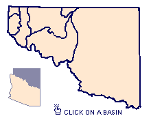
consists of seven groundwater basins known as the Little
Colorado River Plateau Basin, Coconino
Plateau Basin, Paria
Basin, Kanab
Plateau Basin, Shivwits
Plateau Basin, Virgin
River Basin, Grand
Wash Basin.
Most of the planning area lies within the Plateau uplands physiographic province
which is bounded on the south by the Mogollon Rim and on the west by the Grand
Wash cliffs in the western Grand Canyon. The province is characterized by
horizontally stratified sedimentary rocks that have eroded into numerous canyons
and plateaus. The San Francisco Mountains and White Mountains are igneous rocks
deposited on top of the sedimentary formations by recent volcanic activity.
The extreme northwestern portion of the planning area falls within the Basin and
Range physiographic province which is characterized by northwest-southeast
trending mountain ranges separated by broad alluvial valleys.
Climate in the Plateau planning area is controlled by elevation and local
topographic highs. Average annual precipitation ranges from six inches in the
lower desert plains to 35 inches in the White Mountains, Mogollon Rim, and
Humphrey's Peak areas. Average annual temperatures range from 54·F at Winslow
(4,890 feet above mean sea level) to 46·F at Flagstaff (7,010 feet above mean
sea level).
The planning area is bordered on the east, north, and west by the New Mexico,
Utah, and Nevada state lines, respectively. The southern boundary from east to
west follows the Mogollon Rim, San Francisco volcanic field, and Colorado River.
Elevations range from 12,600 feet above mean sea level at Humphrey's Peak, north
of Flagstaff, to 1,200 feet above mean sea level where the Colorado River exits
the planning area downstream of the Grand Canyon. The major populated areas are
within the Little Colorado River Plateau basin and include Flagstaff, Winslow,
Holbrook, Page, and Show Low. The demand for water is concentrated in these
areas, as well as, near Joseph City, along the Mogollon Rim, and on the Navajo
and Hopi Reservations. The planning area falls within Apache, Navajo, Coconino,
and Mohave Counties.
GROUNDWATER -- The Plateau planning area consists of seven groundwater basins. These basins are identified separately below along with a general description of the aquifers:
Little Colorado River Plateau Basin
Coconino Plateau Basin
Paria Basin
Kanab Plateau Basin
Shivwits Plateau Basin
Virgin River Basin
Grand Wash Basin
SURFACE WATER -- The Plateau planning area encompasses a large portion of the Colorado River watershed. For discussion, the area has been organized in two sections. The first provides a brief discussion of the main stem of the Colorado River within the planning area including streamgage records and tributary flow. The second discusses streamflow characteristics for each groundwater basin within the planning area: